 |
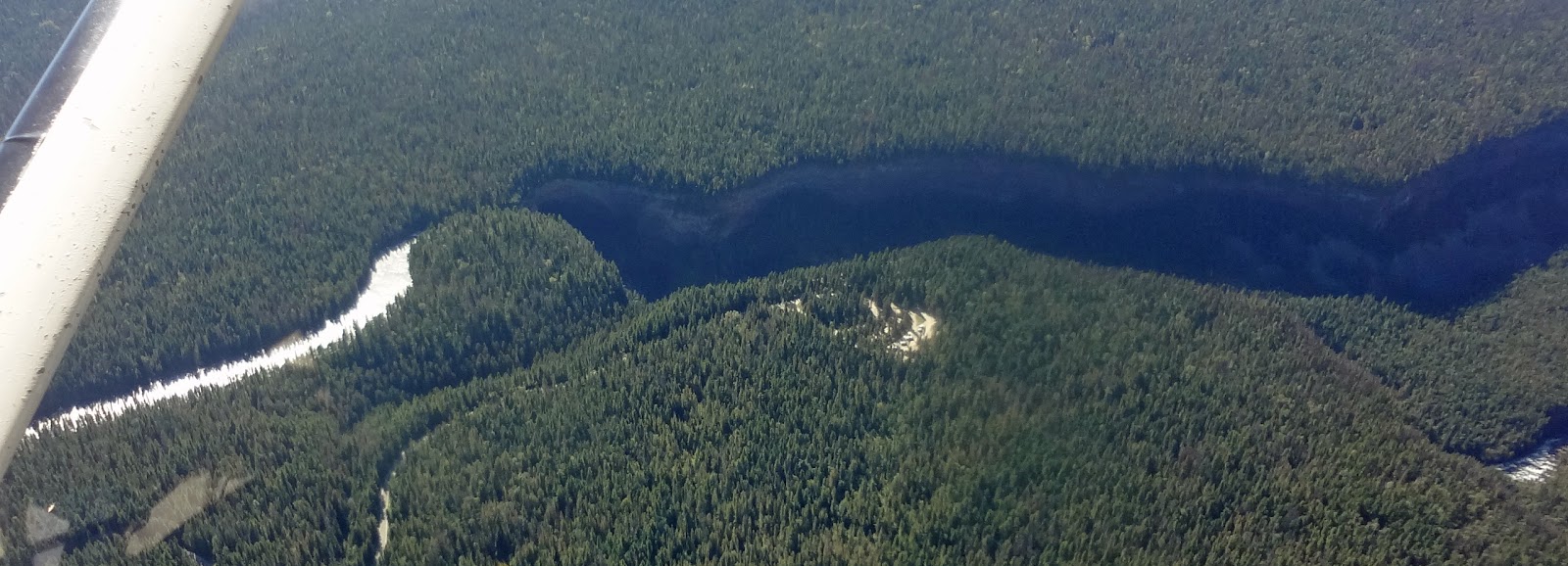
| Great day for fireside flying! |
Tuesday, 25 December 2012
Wednesday, 19 December 2012
Vandalism
One of the downsides of Nakusp's beautiful, sleepy little airport is its isolation. The proximity between town and airport is seen in the large photo in the post below.
Sometimes there are dog walkers, quick to scurry off the runway when a plane approaches. Birds, coyotes and deer are seasonal hazards. Occasionally, usually after a weekend, Bill finds beer bottles near the hanger, likely left by partying teenagers. It is worrying, because it takes very little tampering to affect an aircraft's flight.
The skies cleared briefly yesterday, and we headed to the airport to run the engine and test a new camera. We were shocked to see the wanton destruction of one of the three resident aircraft! An essential part was ripped off a second plane. Damage was done inside a storage hanger. It is possible that the culprits were interrupted as they approached our plane, as our damage was superficial.
It is a Criminal Code offense to tamper with aircraft. Last seen, the RCMP Constable was awaiting the forensic team's arrival from Revelstoke.
http://kootenays.myezrock.com/News/story.aspx?ID=1846080
Perhaps a very real benefit of small town life will apply: someone will squeal.
Wednesday, 28 November 2012
Nakusp
 |
| downtown Nakusp |
http://archive.copanational.org/PlacesToFly/airport_view.php?pr_id=3&ap_id=727
It is a 40 minute drive through countryside - about the same time it took from our apartment in downtown Ottawa to our rentals at the Flying Club at MacDonald-Cartier Airport.
The trick here is anticipating what the weather conditions will be in the next valley west. Recent advances in highway and airport cams lessen the suspense, but Nature often has the last laugh. From November through March it is a guessing game.
Here is a case where there is a hole over Nakusp, but it looks grim southeast over Summit Lake and through to the Slocan Valley...
 |
| looking southeast across the airstrip and village of Nakusp |
Wednesday, 21 November 2012
Air work
 |
| other work today: log booms and tugs |
Here is a flight school that does an excellent job of describing air exercises, plus other aspects of becoming an airworthy pilot:
http://www.langleyflyingschool.com/Pages/Private%20Pilot%20Program.html#5
Bill practises over nearby Halfway Creek (where he spotted the log booms), then heads into Revelstoke for fuel.
 |
| flying home: Nakusp ahead |
 |
| at Revelstoke fuel pump |
Thursday, 8 November 2012
Flyday!
Regular readers can detect a pattern to
our flying adventures. Living in a steep mountain valley, we have
many days – weeks – when the plane sits in its hangar. Our local
sightseeing and our long distance travel happen ad hoc, i.e. when the
skies clear. Aren't we lucky that we are retired and can fit our
excursions around the capriciousness of weather?
Sometimes we awake to this view out our
west windows:
 |
| early November panorama, Slocan Lake and the Valhallas |
Bill checks the airport cam in Nakusp,
and if the skies are as clear there, it's a flyday. Here are some
vistas from just such a serendipitous adventure. Early November is a
transition period. The colourful leaves have fallen. Fire restrictions have ended, and slash burns dot the landscape. Early snow dusts the peaks; valley snow is on the way.
 |
| slash fires on plateau east of Kelowna |
 |
| Pinnacle Lake, west of Nakusp |
 |
| Mt Burnham, west side Upper Arrow Lake |
 | |||||
| Revelstoke ahead |
Tuesday, 6 November 2012
Castlegar - Cancelgar
 |
| Selkirk College, Castlegar, from AC Dash 8 |
 | |||
| rain on landing, Vancouver airport |
Last week I flew Air Canada to Ottawa. These photos were taken on the outbound leg. Not a flying day in the Cessna! Alas, 6 days later was not a flying day for Air Canada either.
Bad weather delayed my return by 24 hours. With mountains at both ends of the runway and outdated navigation electronics in the commercial aircraft that fly this route, Castlegar frequently becomes Cancelgar between November and March. When Castlegar is closed, it means a flight to Kelowna, then a 7 hour + bus ride or 4 hour drive home. What we need is some competition from WestJet. Fingers are crossed that they will take on this route, with their new state-of-the-art regional jets.
Here is the YCG approach, shot in good weather. The comments are interesting, too.
http://www.youtube.com/watch?v=q9gxtADTSAQ
Monday, 22 October 2012
Glacier Tour
 |
| Kokanee Glacier |
http://photopeach.com/album/i65hwq
Jo-Anne has been in many small aircraft, but never above the valley that raised her. She figures that Kazee is a great recreational vehicle - better than a motor home any day!
The path of this flight was recorded by SPOT as
http://www.findmespot.com/spotadventures/index.php/view_adventure?tripid=316413
Tuesday, 16 October 2012
Hovering
 |
| upland valley |
 | |
| mountain tooth |
 |
| larch |
 |
| Rossiter Creek |
 |
| in the mountains |
These vistas look alarmingly close because they were shot from a helicopter. Brother Will was on Forestry business in our area last week. Two hardcore foresters who thought they'd seen it all were spellbound by the scenery. Even the pilot was thrilled to be flying on such a great day! Will reports that more than once they sucked in air as the helicopter barely swooped over a tight pass in the rocks. It was odd to be in the middle of nowhere, then see people in highly remote spots - likely hunters or miners.
Thanks, Will, for sharing these wonderful images!
Sunday, 30 September 2012
Smoke
Since our wettest-ever June, the pendulum has swing the other way. September has been hot and dry. So dry that the fire hazard cancelled sister Barbara's horse trail-riding events near Coombs this weekend. So dry that layers of smoke from forest fires have settled among the peaks and valleys along our familiar air routes.
Here are some unusual views from our recent round trip to Calgary:
Although the beauty of the layers is arresting, I find it unnerving to fly in the murk. I felt the same way about scuba diving in poor visibility. At least with flying there is the potential destination. Celebrating birthdays with family was worth some anxiety over staying on route.
http://www.findmespot.com/spotadventures/index.php/view_adventure?tripid=315650
Here are some unusual views from our recent round trip to Calgary:
 |
| Looking back at New Denver Glacier from Kuskanax Valley |
 |
| Rocky Mountain Trench at Sinclair Pass |
 |
| peaks west of Canmore, Spray Lake |
http://www.findmespot.com/spotadventures/index.php/view_adventure?tripid=315650
Thursday, 27 September 2012
The Incomparable Incomappleux
We love visitors! Bill especially, as he gets lots of treats and doesn't have to rummage around for Auntie Dorothy's freezer-burned pork chop. Sorry, Smith family joke.
With luck, the weather is good and the visitor wants to fly. Such was the case recently when Bill and Vince headed north in a loop across Beaton Arm, up the Incomappleux Valley, into Roger's Pass, and home via Revelstoke. It's not a route for the faint hearted, as there are no emergency landing spots until you break out over the TransCanada, and who wants to mix it up with that traffic?
Vince's photos speak for themselves:
http://www.kizoa.com/slideshow/d3282362k1803915o1/flying-the-incomappleux-peaks
Wednesday, 19 September 2012
Patchwork
A quilter's eye finds something very beautiful about the clearcuts that dot BC's landscape.
From our first flights, we were struck by how cleverly concealed from the highway view most bare tracts are. It reminded Bill and me of our drive from Islamabad to Kabul in 1979. On the sides of the highway were prim fields of grain. But we knew from our UN Development Programme friends that just over the hillside were miles of riotously-coloured poppies, maturing for the opium harvest.
These photos were taken during our flight last week:
It seems that most replanting efforts are haphazard. The spiral pattern of new growth on this hillside stands out:
Opinions on forestry practices abound in our Valley. The gamut ranges from lawn signs proclaiming "Forestry Feeds My Family" to tree police who come running whenever they hear a chainsaw starting up.
Here is one view, from a professional in the field:
http://www.greenbccommunities.com/2012/02/clear-cutting-in-bc-silvicultural.html
From our first flights, we were struck by how cleverly concealed from the highway view most bare tracts are. It reminded Bill and me of our drive from Islamabad to Kabul in 1979. On the sides of the highway were prim fields of grain. But we knew from our UN Development Programme friends that just over the hillside were miles of riotously-coloured poppies, maturing for the opium harvest.
These photos were taken during our flight last week:
 |
| countryside patches in Adams Lake area |
| fresh clearcut |
It seems that most replanting efforts are haphazard. The spiral pattern of new growth on this hillside stands out:
 |
| neat and tidy! |
Here is one view, from a professional in the field:
http://www.greenbccommunities.com/2012/02/clear-cutting-in-bc-silvicultural.html
Monday, 10 September 2012
Saturday Sightseeing
We had hoped to attend Fairmont Hot Spring's first ever Fly-In this weekend. Getting there would not be a problem. With thunderstorms forecast Sunday, getting home would be a challenge. So we flew west, not east, to a destination long on our list: Helmcken Falls in Wells Gray Provincial Park.
Not very impressive, eh? But then Bill swung around for a face-on view, and the majesty of the drop was apparent.
http://www.worldwaterfalldatabase.com/waterfall/Helmcken-Falls-2303/
Websites talk about Helmcken being one of the "best waterfalls in all of North America". With headsets and engine noise, we felt strangely insulated from the view out the windscreen. We had no sense of the roar at the drop, or the height of the spray. Here is one geological attraction best seen on foot!
Part of the 3 hours in the air covered new territory for us. This unnamed lake stood out for its stiking colours around the perimeter:
Our route took us through the northern portion of the Monashee Range. The first tinge of Fall is evident on this knoll:
SPOT did a good job of plotting this circle tour. For routing and more photos, see:
https://www.findmespot.com/spotadventures/index.php/view_adventure?tripid=314757
 | |||||
| Helmcken Falls from above |
 |
| Helmcken Falls and canyon |
http://www.worldwaterfalldatabase.com/waterfall/Helmcken-Falls-2303/
Websites talk about Helmcken being one of the "best waterfalls in all of North America". With headsets and engine noise, we felt strangely insulated from the view out the windscreen. We had no sense of the roar at the drop, or the height of the spray. Here is one geological attraction best seen on foot!
Part of the 3 hours in the air covered new territory for us. This unnamed lake stood out for its stiking colours around the perimeter:
 |
| florescent lake! |
Our route took us through the northern portion of the Monashee Range. The first tinge of Fall is evident on this knoll:
 |
| peaks and valleys in Monashee Range |
https://www.findmespot.com/spotadventures/index.php/view_adventure?tripid=314757
Friday, 7 September 2012
The Slow Lane
 |
| Twin Lakes. Photo credit: Skip Young |
This idyllic site, nestled in the Purcell Range, is rich in cutthroat trout.
http://www.adventurevalley.com/category.html?cat=Fishing/Hunting
Hoping to find out more, I googled Twin Lakes, Invermere, and discovered another sports pastime:
http://www.youtube.com/watch?v=fTOZKYq8Mto&feature=related
Skip assures me that 'his' Twin Lakes have neither the elevation nor the depth for cliff diving. It got me thinking about the lack of imagination in BC place names. We have a Bear Lake and a Fish Lake near us, and even the locals disagree on which is which. Cedar Creek is another ubiquitous place name. What examples can you contribute, dear readers?
Wednesday, 29 August 2012
Lake of the Hanging Glaciers
For aerial glacier viewing, you can't
beat the chunk of Purcells surrounding the much-discussed Jumbo
Mountain, near Invermere.
One of the most glorious sites is Lake
of the Hanging Glaciers. It is accessible by foot.
The 3 hour, 16
km round trip from trail head has rave reviews in the hiking
community, and why not, considering the reward?
 |
| Lake of the Hanging Glaciers, August 25, 2012 |
This beautiful video puts you in the
scene:
Just looking at all that nimble trudging makes my healing
foot ache. Much easier to view it from 10,000 feet.
 |
| MacBeth Icefield |
 |
| Spokane Glacier on Mt. Cooper |
While in the area, Bill scooted around other glaciers and icefields. You can see from the horizon that he likes to get a mountain goat's view of the glacier toes! They remind me of elephant feet.
Sunday, 26 August 2012
Where's my gun?
 |
| bear in our yard |
Living in the mountains of BC means living with wildlife, even in the Village, it seems.
This little fellow, likely his first year on his own, appears to have adopted us. The other morning, on early departure for Calgary, Bill heard him snorting in a hollow near our compost. Bear was none too cheered to be chased into the north woods. That night he feasted in our crabapple tree. The next morning he cruised the raspberry canes. One day he ambled along the beach shoreline, in full view of swimmers, including our kiddies on the diving pole. Another day he chased Bill and me up the cabin path from the beach and into the safety of the truck.
 |
| bear at the beach |
 |
| bear at the cabin |
Alas, things will not end well for Bear. Despite best efforts from Bear Aware and Harvest Share (a program where volunteers pick your fruit and keep half), this fellow has become habituated to village life. When the harried Conservation Officer out of Grand Forks catches up with his workload, Bear will be trapped and shot. In the meantime, we carry bear bangers.
Wednesday, 22 August 2012
Flying at its best!
At last a trip!
It was time for the grandkiddies to return home after 3 weeks of idyllic summer activities. The choice? 8 hours on the road with ferry line-ups and camper traffic on the TransCanada, OR 2 hours in the air. Yes, that was the flying time, actually 1 hour 50 minutes direct Nakusp to Calgary/Springbank.
We did a one day round trip, circle route. With the drive to and from Nakusp, the walkaround and loading, the fuel and lunch stop in Springbank, the shutdown and hangaring, the grocery shopping on the way home, we were gone from the house for 9 hours.
It was a glorious, perfect blue sky day! We started and finished early to beat the thermals and bumpy air that build up during daytime heating. Our route and accompanying photos are displayed in this Spot Adventure link:
http://www.findmespot.com/spotadventures/index.php/view_adventure?tripid=313656
As well as functioning as an emergency beacon, SPOT takes GPS readings every 10 minutes, and records these as tracking points. The route that you see is actual, not drawn. If you are following the blog, please motor around in the Spot Adventure site and become familiar with its features - the zoom and drag; map vs. satellite background; larger view of photos by clicking on the photo strip. I like this format, and couldn't possibly do a better job of trip summary.
Photo of the day is Castle Mountain, a site that never fails to impress. Imposing by road, it is majestic by air.
http://www.peakfinder.com/peakfinder.ASP?PeakName=castle+mountain+%28alberta%29
This amazing structure was a fine tribute to General Eisenhower during the 33 years it bore his name, but let's face it, "castle" fits!
Finally, a train photo for Jay, along with the observation that it is a good time to hold CP shares. For the first time in years the rail yard in Field was empty, which means the rolling stock is hauling freight. Hunter Harrison is not wasting any time turning around our national railway.
It was time for the grandkiddies to return home after 3 weeks of idyllic summer activities. The choice? 8 hours on the road with ferry line-ups and camper traffic on the TransCanada, OR 2 hours in the air. Yes, that was the flying time, actually 1 hour 50 minutes direct Nakusp to Calgary/Springbank.
We did a one day round trip, circle route. With the drive to and from Nakusp, the walkaround and loading, the fuel and lunch stop in Springbank, the shutdown and hangaring, the grocery shopping on the way home, we were gone from the house for 9 hours.
 |
| Supervising the walkaround |
http://www.findmespot.com/spotadventures/index.php/view_adventure?tripid=313656
As well as functioning as an emergency beacon, SPOT takes GPS readings every 10 minutes, and records these as tracking points. The route that you see is actual, not drawn. If you are following the blog, please motor around in the Spot Adventure site and become familiar with its features - the zoom and drag; map vs. satellite background; larger view of photos by clicking on the photo strip. I like this format, and couldn't possibly do a better job of trip summary.
 | ||||||
| Castle Mountain, 8,500 feet |
http://www.peakfinder.com/peakfinder.ASP?PeakName=castle+mountain+%28alberta%29
This amazing structure was a fine tribute to General Eisenhower during the 33 years it bore his name, but let's face it, "castle" fits!
 |
| Speed train in Albert Canyon |
Wednesday, 15 August 2012
Tracking
Airplanes are like All Terrain Vehicles: point in any direction and go. Literally, the sky is the limit!
Of course, there are some rules, for example maintaining a cruising altitude determined by whether you are flying east or west. The more congested the airspace, the longer the rule book. You can't fly into the Lower Mainland or major cities unless your plane is equipped with a transponder. This allows you to be identified by a blip on a radar screen. You fly very prescriptive approaches and departures, and are yelled at by Air Traffic Controllers if you deviate.
Before we take off - anywhere - Bill files a flight plan with Nav Canada. His flight path to the Coast goes like this: "Nakusp departure, overhead Kelowna, GPS direct to overhead the Coquihalla Toll Booth, overhead Hope, overhead Chilliwack to Kilgard check point, direct Boundary Bay." He estimates an arrival time, must close the flight plan on landing, and has 30 minutes grace before Search and Rescue goes into action.
Although little information has been released about the recent crash out of Penticton, two facts have been: the Piper deviated from its filed flight plan; activation of the plane's ELT (Emergency Locator Transmitter) directed SAR to the accident site almost immediately.
Most Canadian aircraft are required to carry a functioning ELT. We fly to Creston every second year to have ours checked and certified by a specialized technician. Our ELT is mounted beside the left rear seat, and that passenger is instructed not to play with it, as we don't want a SAR Buffalo suddenly appearing on our wing tip! It can be activated by hand, and theoretically emits a signal when the plane crashes. In practice, it fails to activate more than half the time - appalling in this age of technology. Controversy abounds on how planes can be better tracked:
http://www.avweb.com/blogs/insider/Time_To_Replace_ELTs_203244-1.html
For redundancy, we carry a Personal Locator Beacon in the form of a SPOT device. It has a 911 button that broadcasts our GPS coordinates, providing it sees the satellite.
In the case of the Piper - miles off its flight plan, in wooded terrain - the ELT worked, and people are alive as result.
Of course, there are some rules, for example maintaining a cruising altitude determined by whether you are flying east or west. The more congested the airspace, the longer the rule book. You can't fly into the Lower Mainland or major cities unless your plane is equipped with a transponder. This allows you to be identified by a blip on a radar screen. You fly very prescriptive approaches and departures, and are yelled at by Air Traffic Controllers if you deviate.
Before we take off - anywhere - Bill files a flight plan with Nav Canada. His flight path to the Coast goes like this: "Nakusp departure, overhead Kelowna, GPS direct to overhead the Coquihalla Toll Booth, overhead Hope, overhead Chilliwack to Kilgard check point, direct Boundary Bay." He estimates an arrival time, must close the flight plan on landing, and has 30 minutes grace before Search and Rescue goes into action.
Although little information has been released about the recent crash out of Penticton, two facts have been: the Piper deviated from its filed flight plan; activation of the plane's ELT (Emergency Locator Transmitter) directed SAR to the accident site almost immediately.
 |
| ELT easily accessible |
Most Canadian aircraft are required to carry a functioning ELT. We fly to Creston every second year to have ours checked and certified by a specialized technician. Our ELT is mounted beside the left rear seat, and that passenger is instructed not to play with it, as we don't want a SAR Buffalo suddenly appearing on our wing tip! It can be activated by hand, and theoretically emits a signal when the plane crashes. In practice, it fails to activate more than half the time - appalling in this age of technology. Controversy abounds on how planes can be better tracked:
http://www.avweb.com/blogs/insider/Time_To_Replace_ELTs_203244-1.html
For redundancy, we carry a Personal Locator Beacon in the form of a SPOT device. It has a 911 button that broadcasts our GPS coordinates, providing it sees the satellite.
 |
| handy SPOT |
Tuesday, 14 August 2012
Crashes
Yes, planes crash. So do cars, snowmobiles and bikes, often with deadly results. Although we have a greater chance of being flattened by a chiptruck on the way to the airstrip than flying into a rock wall, facts are no match for irrational fears. The media feeds fears with a wonderful job of reporting each and every air accident.
A Piper crashed out of Penticton yesterday on a route that we take each time we fly to the Coast. We know the Brenda Mine site well. It sits at about 5,000 ft elevation, just east of the summit of the Connector. It's a stunning distraction in a boring landscape that I usually knit through.
Although we normally overfly Kelowna at 8,500 feet and notify the Tower that we are in the airspace as courtesy only, a take-off from Kelowna or Penticton requires considerable climbing to maintain a safe altitude over the central plateau. The hotter the day, the thinner the air, and the longer it takes to gain altitude. The more passengers or cargo, the heavier the plane, and the longer it takes to gain altitude. It's pretty basic physics: if the terrain rises up at you faster than you can climb, you crash.
It will be months before this accident investigation is made public, but when it is, every private pilot in Canada will receive the results. Education is a huge key to pilot safety. We learn from mistakes, and thankfully, in this case, so may three of the four people in that Piper. Our prayers are with them, and the pilot's family.
http://www.cbc.ca/news/canada/british-columbia/story/2012/08/13/bc-kelowna-plane-crash.html
A Piper crashed out of Penticton yesterday on a route that we take each time we fly to the Coast. We know the Brenda Mine site well. It sits at about 5,000 ft elevation, just east of the summit of the Connector. It's a stunning distraction in a boring landscape that I usually knit through.
 |
| Brenda Mine site, July 6, 2012 |
It will be months before this accident investigation is made public, but when it is, every private pilot in Canada will receive the results. Education is a huge key to pilot safety. We learn from mistakes, and thankfully, in this case, so may three of the four people in that Piper. Our prayers are with them, and the pilot's family.
http://www.cbc.ca/news/canada/british-columbia/story/2012/08/13/bc-kelowna-plane-crash.html
Monday, 13 August 2012
New Denver Glacier
Bill slipped away from the family hub-bub last week to put more time on his new engine. With the extra horsepower, our favourite wow-the-visitor sightseeing jaunt is easily doable in hot weather. On takeoff from Nakusp, Bill follows Upper Arrow Lake to Burton, then hops over the back of the Valhallas to emerge on top of 'our' glacier. Breathtaking!
If I could find and scan a similar photo taken when I first saw New Denver (1964), there would be far more ice and snow. Global Warming or natural ebb and flow? No doubt in this valley. The receding glacier has been well-tracked:
http://www.slocanlake.net/glacier_.html
The climber in this video has a pessimistic opinion of its demise: http://www.youtube.com/watch?v=h0_q1AK8TT0
Here's the view of New Denver that his camera could not capture, thanks to Chris who snapped this on a similar flight path in July 2009:
 |
| New Denver Glacier from bedroom deck |
 |
| New Denver Glacier, up close and personal |
If I could find and scan a similar photo taken when I first saw New Denver (1964), there would be far more ice and snow. Global Warming or natural ebb and flow? No doubt in this valley. The receding glacier has been well-tracked:
http://www.slocanlake.net/glacier_.html
The climber in this video has a pessimistic opinion of its demise: http://www.youtube.com/watch?v=h0_q1AK8TT0
Here's the view of New Denver that his camera could not capture, thanks to Chris who snapped this on a similar flight path in July 2009:
 |
| Overtop New Denver Glacier with Village beyond |
Monday, 6 August 2012
Above New Denver
One of our favourite flights is very close to home - 5,000 ft above the house!
Carpenter Creek bisects the Village, with the Orchard, Health Centre, Campground, and Marina on the south side. To the north are Main Street and the school. Our house is at S-curve at the far north of town. Our cabin is on Bigelow Bay, a two minute walk down the forested hillside.
Today there was an excursion to Idaho Peak lookout. It's a 12 km drive from Sandon on a bumpy mostly one-vehicle-wide forestry road, followed by a 40 minute hike along a ridge. At more than 5,000 ft above New Denver, it is almost like being in the plane!
The spectacular views make it our most popular tourist
destination. With the snow at that elevation (7,400 ft), Idaho Peak is
accessible only briefly mid-summer. If you miss the window of opportunity on your visit here, catch this 360 degree view from the old Forestry Lookout:
http://www.youtube.com/watch?v=TgQ18laviO0
 |
| New Denver, population 556 |
 |
| Distances are small in our tiny, perfect Village! |
 |
| A different kind of flying: Jay on the Laser, Bigelow Bay |
Today there was an excursion to Idaho Peak lookout. It's a 12 km drive from Sandon on a bumpy mostly one-vehicle-wide forestry road, followed by a 40 minute hike along a ridge. At more than 5,000 ft above New Denver, it is almost like being in the plane!
 |
| Alamo Basin, on climb to Idaho Peak |
 |
| Slocan Lake and New Denver from Idaho Peak |
http://www.youtube.com/watch?v=TgQ18laviO0
Subscribe to:
Comments (Atom)